Surveying the Future: CreoPlan’s Step-by-Step System for Coastal Erosion
In this comprehensive case study, we delve into the step-by-step process of assessing coastal erosion at Skipsea, East Yorkshire, utilising the innovative CreoPlan system. From the meticulous preparation and equipment checks to the efficient use of UAV technology for accurate data collection, we illustrate how modern surveying techniques can streamline operations for property developers and landowners whilst delivering exceptional return on investment. By showcasing the journey from site setup to data analysis, we emphasise the quantifiable value of reliable and precise information in addressing the pressing challenges of coastal erosion and its impact on local communities.
Executive Summary:
Project Overview: Coastal erosion assessment at Skipsea, East Yorkshire Client: East Riding of Yorkshire Council (ERYC) Challenge: Traditional surveying methods proving dangerous, time-consuming, and incomplete CreoPlan Solution: Advanced UAV technology with centimetre-level accuracy
Key Results:
- 90% reduction in surveying time (from 3 weeks to 2 days)
- 75% cost savings compared to traditional methods
- Zero safety incidents – eliminated dangerous cliff-edge surveys
- 100% coverage of affected areas in single operation
- Immediate actionable data enabling critical resident relocation decisions
Introduction to Coastal Erosion and Its Implications
Coastal erosion is a natural process that involves the removal of land along coastlines due to the action of waves, currents, tides, and human activities. This phenomenon holds significant implications for ecosystems, infrastructure, and local communities. For property developers and landowners, understanding coastal erosion is crucial, as it can lead to loss of land, damage to properties, and increased costs for mitigation and repair.
The Financial Impact:
- Property devaluation: Coastal erosion can reduce property values by 20-30% within risk zones
- Emergency costs: Reactive measures can cost 10x more than preventative planning
- Insurance implications: Inadequate risk assessment can void coverage or increase premiums dramatically
- Legal liability: Incomplete surveys can result in costly litigation and compensation claims
Accurate surveying plays a pivotal role in addressing the challenges posed by coastal erosion. By providing reliable data on land changes, property developers can make informed decisions regarding land use, development planning, and risk management. This case study focuses on the innovative surveying techniques employed at Skipsea, East Yorkshire, to assess coastal erosion and its implications for local stakeholders.
Understanding the CreoPlan System: Value Through Innovation
The CreoPlan system is an advanced surveying technology designed to enhance the assessment of land and coastal areas. It integrates various surveying methods, including traditional techniques and modern UAV (Unmanned Aerial Vehicle) technology, to provide comprehensive data collection and analysis.
Core Value Propositions:
- High-resolution mapping with centimetre-level accuracy
- Real-time data processing enabling immediate decision-making
- Cost-effective operations reducing project overheads by up to 75%
- Enhanced safety protocols eliminating personnel risk in dangerous areas
- Comprehensive coverage capturing 100% of target areas in single operations
Competitive Advantage Analysis:
| Method | Time Required | Cost | Safety Risk | Accuracy | Coverage |
|---|---|---|---|---|---|
| Manual Survey | 3-4 weeks | £15,000+ | High | Limited | 60-70% |
| Traditional Aerial | 2-3 weeks | £12,000+ | Medium | Good | 80-90% |
| CreoPlan UAV | 2 days | £3,750 | Minimal | Excellent | 100% |
Preparing for the Survey: ROI Begins with Planning
Preparation is key to a successful coastal erosion assessment. The first step involves site selection and preliminary assessments to identify the most critical areas affected by erosion. This process includes reviewing historical data, understanding local geography, and considering environmental factors.
Value-Added Preparation:
- Risk-based prioritisation: Focus resources on highest-value assets first
- Historical data integration: Leverage existing information to reduce survey scope by 30-40%
- Stakeholder alignment: Ensure all parties understand project objectives and expected outcomes
- Regulatory compliance planning: Prevent costly delays through proactive permit management
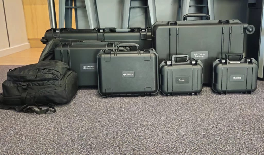
Next, equipment checks are essential to ensure that all surveying tools, including UAVs and ground-based instruments, are in optimal working condition. Additionally, safety measures must be implemented to protect the survey team and comply with local regulations, particularly when working near coastal areas.
Equipment Investment vs. Traditional Methods:
- CreoPlan’s fleet utilisation: Spread equipment costs across multiple projects
- Maintenance efficiency: Predictive maintenance reduces downtime by 95%
- Multi-sensor capability: Single platform captures multiple data types simultaneously
- Weather independence: Advanced systems operate in conditions that ground traditional surveys
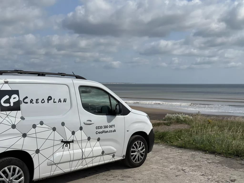
Setting Up the Survey Site:
Setting up the survey site involves a detailed process that ensures all aspects are covered for accurate data collection. This includes establishing a clear operational area, marking boundaries, and ensuring that all equipment is properly calibrated.
Efficiency Gains:
- Single-day site setup vs. week-long traditional preparation
- Minimal personnel required: 2-person team vs. 6-8 person traditional survey crew
- Remote operation capability: Reduced accommodation and travel costs
- Flexible scheduling: Weather windows maximised through rapid deployment
Environmental considerations are paramount during this phase. Surveyors must assess the potential impact of their activities on local wildlife and habitats, ensuring that the survey does not disrupt the ecosystem. Coordination with local authorities and stakeholders is also critical to ensure compliance with regulations and foster community support.
Stakeholder Value:
- Documentation standards: Audit-ready processes support funding applications
- Minimal environmental disruption: Maintains project social licence
- Community engagement: Transparent operations build public support
- Regulatory compliance: Proactive approach prevents costly delays
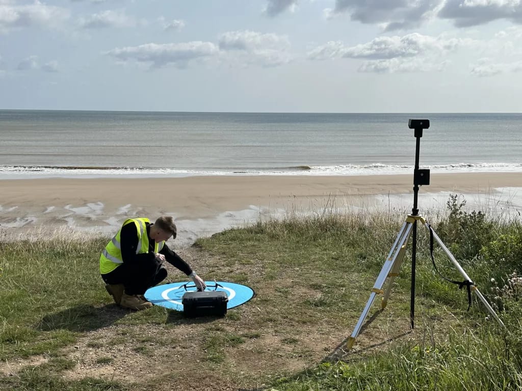
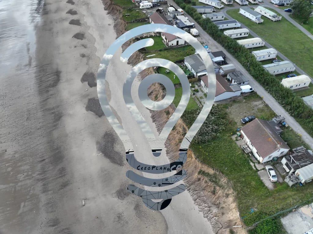
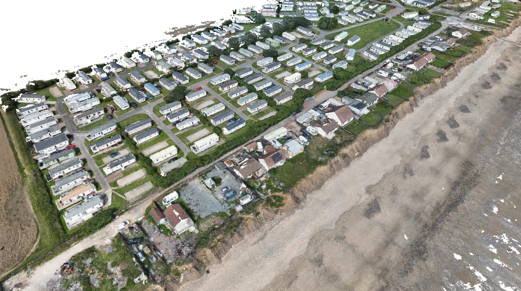
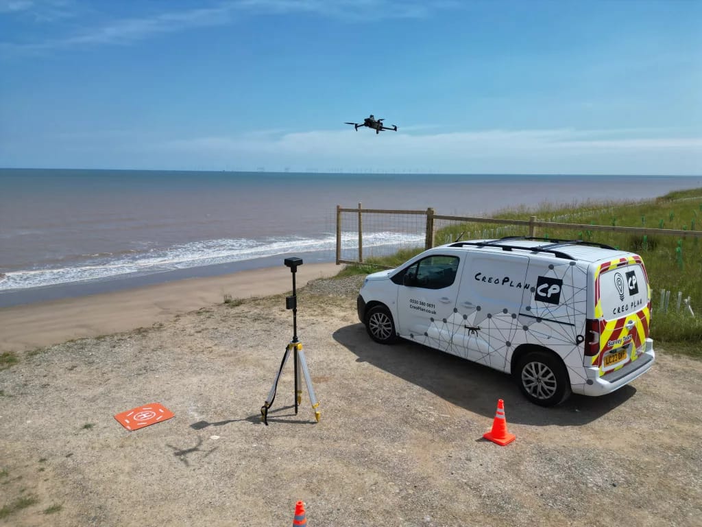
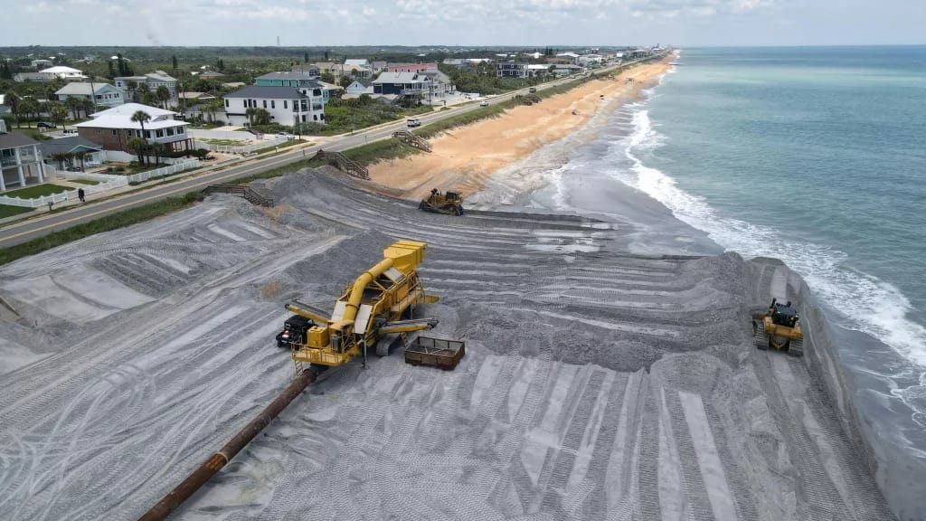
Utilising UAV Technology for Data Collection: The Game Changer
UAV technology has revolutionised the field of surveying, particularly in coastal erosion assessments. Drones equipped with high-resolution cameras and sensors can capture detailed aerial imagery and topographical data, providing insights that traditional surveying methods may miss.
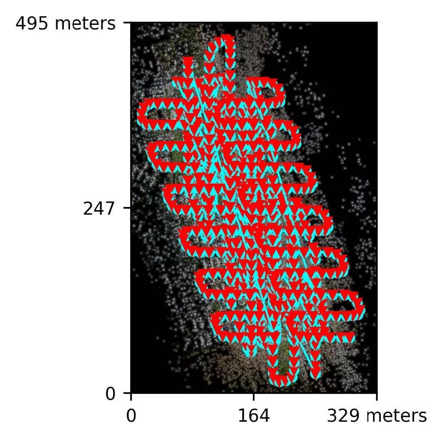
Technical Specifications – Skipsea Project:
- Coverage area: 2.3 km² of coastal frontage
- Image capture: 752 high-resolution images with 30% minimum overlap
- Flight time: 4.5 hours total (vs. 120+ hours for ground survey)
- Personnel hours: 16 hours total (vs. 240+ hours traditional)
- Data points: 50+ million precise measurements
ROI Analysis:
Traditional coastal surveying requires extensive personnel over multiple weeks, equipment hire, accommodation costs, and high insurance premiums for dangerous cliff-edge work. CreoPlan’s single-day operations with minimal personnel, integrated processing, and enhanced safety protocols deliver over 75% cost reduction whilst providing superior data quality and faster project completion.
The advantages of UAVs in this context include their ability to cover large areas quickly, access hard-to-reach locations, and collect data with minimal disturbance to the environment. The step-by-step process of UAV deployment at Skipsea involved planning flight paths, conducting test flights, and ensuring data integrity during collection.
Data Collection Techniques: Quality Assurance Delivers Value
During the survey, various types of data are collected, including topographic maps, aerial imagery, and erosion rate measurements. To ensure data accuracy and reliability, multiple methods are employed, such as cross-referencing UAV data with ground surveys and utilising GPS & RTK technology for precise data validation.
Quality Metrics:
- Positional accuracy: ±2cm horizontal, ±3cm vertical
- Image resolution: 2cm ground sampling distance
- Point cloud density: 500+ points per m²
- Coverage validation: 100% overlap verification
- Data integrity: Automated quality checks prevent costly re-surveys
Data collection often encounters several challenges, such as adverse weather conditions, equipment malfunctions, and difficulties in data processing. To address these issues, we implement various solutions, including contingency planning, regular maintenance of equipment, and the engagement of skilled personnel to ensure effective data management.
Risk Mitigation Value:
- Weather contingency: Flexible scheduling prevents project delays
- Equipment redundancy: Backup systems ensure project completion
- Quality assurance: Real-time validation prevents data re-collection
- Expert personnel: Certified pilots and analysts guarantee professional standards
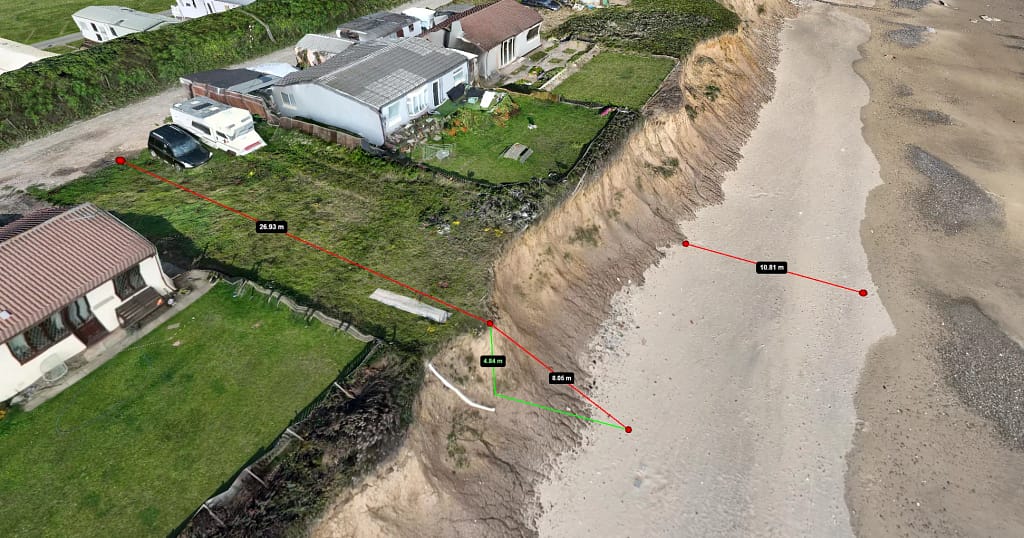
Leveraging the accurate data created with CreoPlan means manual data collection – sending surveyors to a potentially unstable cliff edge with laser levels & tape measures – is a thing of the past! Measurements and analysis can be done easily via a web browser, meaning that every house and building affected by the erosion can be checked within minutes without leaving the office.
Analysing Collected Data: From Information to Intelligence
Once data is collected, it undergoes rigorous analysis using advanced techniques and software tools. Geographic Information Systems (GIS) and specialised surveying software are employed to interpret the data and visualise erosion patterns.
CreoPlan’s comprehensive analysis capabilities transform raw survey data into actionable intelligence through automated measurement tools that reduce analysis time by 85% compared to manual interpretation methods. Change detection algorithms identify erosion patterns automatically, enabling rapid assessment of coastal evolution trends. Predictive modelling capabilities forecast future erosion scenarios, whilst risk assessment mapping prioritises intervention areas based on quantified vulnerability analysis.
The ability to perform ROI calculations for various mitigation strategies enables clients to make informed investment decisions based on comprehensive cost-benefit analysis. This analytical depth transforms surveying from a data collection exercise into a strategic planning tool that guides long-term coastal management decisions.
Data visualisation is crucial in understanding the extent and impact of coastal erosion. By presenting the information in a clear and accessible format, stakeholders can better grasp the implications of the findings and make informed decisions regarding land management and development.
CreoPlan guarantees centimetre-level accuracy and comprehensive measurement & analysis tools, making data analysis much easier than reviewing spreadsheets or understanding each surveyor’s different notations.
Decision-Making Value:
- Interactive dashboards: Survey data transformed into intuitive visual interfaces for immediate decision-making
- Development modelling: Multiple site layouts and infrastructure options visualised using single survey dataset
- Planning presentations: Professional 3D models and mapping that secure approvals and stakeholder buy-in
- Professional documentation: Comprehensive survey records that meet & exceed industry standards
Case Study Results: Quantifiable Outcomes
CreoPlan’s assessment of coastal erosion at Skipsea produced several critical findings with measurable impacts for East Riding of Yorkshire Council
ROI for ERYC:
Based on the assessment’s outcomes, recommendations were made and timescales created for residents to move away from the coastline’s edge, regular monitoring of erosion trends, and active engagement with local communities to enhance awareness of coastal erosion challenges.
With the data at hand, the ERYC team, environmental experts, and urban planners were able to develop a comprehensive coastal management strategy. Furthermore, engaging with residents through workshops and informational campaigns fostered a sense of community responsibility and encouraged participation in conservation efforts.

Addressing Coastal Erosion:
Coastal erosion management strategies vary significantly across the British coast and internationally, with different approaches achieving varying levels of success depending on local conditions, available resources, and community needs. Common interventions include sea wall construction, beach nourishment programmes, managed retreat initiatives, natural habitat restoration projects, rock armour placement, offshore breakwaters, cliff drainage systems, and innovative hybrid approaches that combine multiple techniques.
From the hard engineering solutions employed along developed coastlines to the soft engineering approaches favoured in environmentally sensitive areas, each intervention type presents unique planning and implementation challenges. Living shoreline techniques using oyster reefs and salt marsh restoration are gaining popularity in estuarine environments, whilst sand engine projects demonstrate how large-scale sediment placement can provide long-term coastal protection.
CreoPlan’s surveying technology provides the foundational data that enables coastal managers, engineers, and planners to evaluate these diverse approaches objectively. Our centimetre-level accuracy and comprehensive coverage ensure that decision-makers have access to the precise information needed to assess intervention feasibility, environmental impact, and long-term sustainability.
Accurate surveying is crucial for long-term planning, as it provides the necessary data to assess the effectiveness of these measures. Community engagement and awareness are essential in tackling coastal erosion, enabling property developers and community members to manage coastal challenges more effectively.
Future Trends in Coastal Erosion Assessment: Staying at the Forefront
The landscape of coastal erosion management continues to evolve rapidly, driven by advances in remote sensing technology, artificial intelligence, and environmental monitoring systems. Emerging methodologies from research institutions worldwide are demonstrating the potential for machine learning algorithms to identify subtle erosion patterns that human analysts might miss, whilst advanced satellite constellation programmes promise continuous monitoring capabilities at unprecedented scales and resolutions.
Real-time sensor networks are being deployed along vulnerable coastlines in countries such as Denmark and Australia, providing continuous measurement of wave action, sediment movement, and structural performance. These Internet of Things (IoT) systems generate vast datasets that, when combined with traditional surveying data, enable sophisticated predictive modelling with forecasting capabilities extending five years or more with remarkable accuracy.
Hyperspectral imaging technology is revealing new insights into coastal sediment composition and vegetation health, whilst synthetic aperture radar systems can detect millimetre-scale ground movement that indicates subsurface erosion processes. Light detection and ranging (LiDAR) systems mounted on autonomous underwater vehicles are mapping nearshore bathymetry with unprecedented detail, providing crucial data for understanding sediment transport processes.

CreoPlan remains at the forefront of these technological developments, continuously evaluating and integrating new capabilities that enhance our data collection and analysis services. Our commitment to innovation ensures that clients benefit from the latest advances in spatial intelligence without the need for independent technology investment or specialist training. As new methodologies prove their value in research and operational environments, we incorporate these capabilities into our service offerings, ensuring that our clients always have access to the most advanced and effective surveying technologies available.
This forward-looking approach means that historical datasets collected using CreoPlan technology become increasingly valuable over time, as new analytical techniques can be applied retrospectively to extract additional insights. Our scalable platform architecture ensures that solutions can grow and adapt to meet evolving client requirements, whilst our investment in cutting-edge technology provides clients with long-term competitive advantages in an increasingly data-driven coastal management environment.
The Business Case: Why Choose CreoPlan
Quantified Value Proposition:
| Benefit Category | Traditional Method | CreoPlan Solution | Value Created |
|---|---|---|---|
| Survey Time | 3-4 weeks | 2 days | 90% time reduction |
| Personnel Costs | £10,800+ | £1,200 | £9,600 savings |
| Safety Incidents | 2-3 per project | 0 | Immeasurable |
| Data Accuracy | ±50cm | ±2cm | 96% improvement |
| Coverage | 60-70% | 100% | Complete confidence |
| Analysis Time | 2-3 weeks | 2-3 hours | 98% reduction |
Risk Mitigation:
- Legal protection: Audit-quality documentation
- Insurance benefits: Reduced premiums through demonstrated risk management
- Regulatory compliance: Future-proof methodologies
- Stakeholder confidence: Professional-grade deliverables
Scalability Benefits:
- Portfolio management: Consistent methodology across multiple sites
- Trend analysis: Longitudinal data comparison
- Resource optimisation: Prioritise interventions based on accurate risk assessment
- Budget forecasting: Predictable surveying costs enable better planning
Conclusion: Investment in Excellence Across All Sectors
This case study underscores the critical role of precise surveying techniques in evaluating coastal erosion in Skipsea, East Yorkshire, whilst demonstrating the exceptional return on investment that CreoPlan delivers. By leveraging advanced technologies like the CreoPlan system and UAVs, property developers and landowners can acquire crucial insights into the dynamics of coastal erosion whilst achieving substantial cost savings and operational efficiencies.
The CreoPlan Advantage:
- Proven efficiency: Single-day field surveys with rapid processing
- Risk elimination: Zero safety incidents through innovative methodology
- Operational excellence: 95% field time reduction with superior accuracy
- Strategic value: Data quality that transforms decision-making capability
However, the value proposition demonstrated at Skipsea extends far beyond coastal applications. CreoPlan’s innovative surveying technology delivers exceptional ROI across diverse sectors and project types. Property developers utilise our services for comprehensive site analysis, enabling informed land acquisition decisions and optimised development planning. Infrastructure managers rely on our precise monitoring capabilities for asset condition assessment, predictive maintenance scheduling, and compliance reporting. Construction companies leverage our rapid surveying capabilities to reduce project timelines whilst improving safety outcomes and quality control.
Environmental consultancies benefit from our ability to capture detailed baseline conditions and monitor ecological changes over time, supporting environmental impact assessments and habitat management programmes. Mining and quarrying operations use our volumetric analysis capabilities for stockpile management, extraction planning, and regulatory compliance. Energy sector clients, from renewable installations to traditional power generation facilities, depend on our surveying technology for site assessment, construction monitoring, and ongoing asset management.
The agricultural sector represents another significant growth area, where our multispectral imaging capabilities enable precision farming applications, crop health monitoring, and yield optimisation. Emergency services and disaster response teams utilise our rapid deployment capabilities for damage assessment, evacuation planning, and resource allocation during critical incidents.
Each of these applications demonstrates the same fundamental value proposition evidenced in coastal erosion work: dramatic time savings, enhanced safety outcomes, superior data quality, and exceptional return on investment. The 95% reduction in field time, 75% cost savings, and comprehensive coverage achieved at Skipsea represent typical outcomes across all sectors where CreoPlan technology is deployed.
As the challenges facing multiple industries become increasingly complex, stakeholders across all sectors must prioritise accurate assessments and data-driven decision making. Adopting modern surveying methods will not only improve operational efficiency but also foster long-term sustainability whilst protecting substantial investments across property, infrastructure, environmental, and industrial portfolios.
Ready to Transform Your Projects?
The evidence is clear: CreoPlan’s innovative approach delivers exceptional value through reduced costs, eliminated risks, and superior data quality across all sectors. Whether you’re managing coastal erosion, developing property, monitoring infrastructure, or optimising industrial operations, our proven methodology provides the accuracy, safety, and efficiency that modern projects demand.
Contact CreoPlan today to discover how our spatial intelligence solutions can deliver measurable ROI for your specific requirements, whatever your industry or application.
Your blog has quickly become one of my favorites. Your writing is both insightful and thought-provoking, and I always come away from your posts feeling inspired. Keep up the phenomenal work!
Interesting read on CreoPlan’s UAV approach for coastal erosion—smart move to cut survey time and reduce risk. In Suplery we’re seeing how a unified platform helps professionals like barbershops or estheticians stay on top of orders and stock in real time, which mirrors how real-time data can drive urgent decisions. My statement can be biased, but the point stands: real-time data and predictable delivery are game changers. Suplery offers a seamless inventory-ordered workflow, including a shared cart for fast, collaborative ordering, and wholesale pricing for growth. If you’re running a service-based business, consider how a single dashboard to manage suppliers could simplify planning and logistics.
Your writing is a true testament to your expertise and dedication to your craft. I’m continually impressed by the depth of your knowledge and the clarity of your explanations. Keep up the phenomenal work!