INNOVATIVE
SOLUTIONS FOR
COMPLEX CHALLENGES
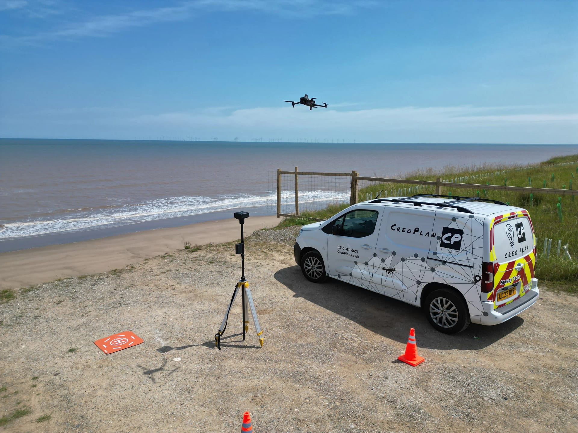
SURVEYING
→High-precision UAV surveys and LiDAR scanning for comprehensive spatial analysis.
Our surveying expertise combines cutting-edge UAV technology with advanced LiDAR systems to deliver unmatched precision in spatial data collection. With our fleet of specialised drones and experienced team, we provide detailed aerial surveys, accurate volumetric calculations, and comprehensive site documentation.
- Aerial Photography & Mapping
- Volumetric Analysis
- 3D Modeling & Digital Twins
- Site Documentation
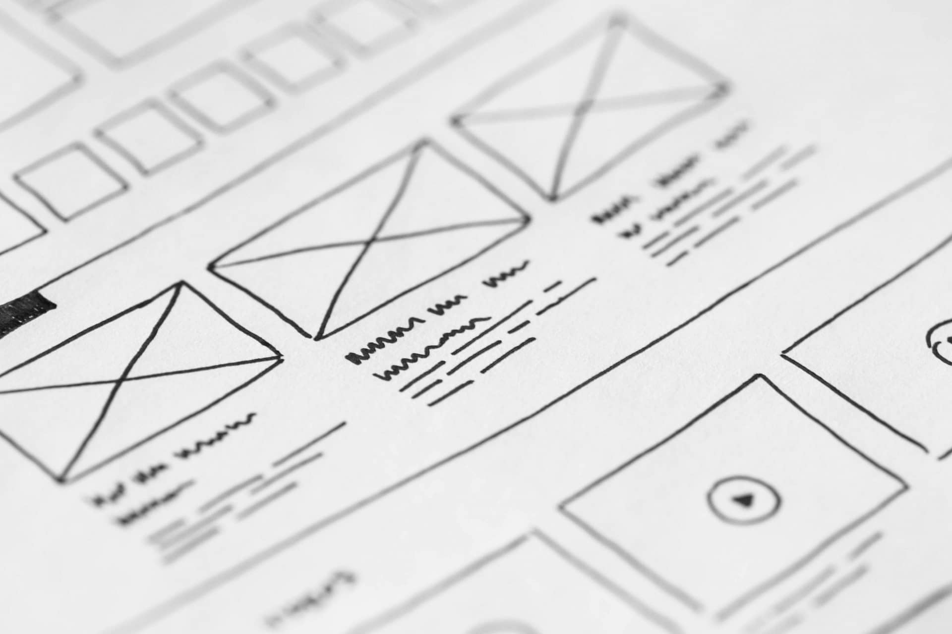
WEB & SYSTEMS
→Custom development solutions for enterprise-grade spatial applications.
Our web and systems development services emerged from our internal innovation journey. After developing sophisticated systems for our own workflows, we recognised our clients' need for more than just basic solutions. Our team's expertise in creating custom applications and integrated systems allows us to deliver comprehensive solutions that bridge the gap between spatial data and user-friendly interfaces.
- Custom Software Development
- Web Applications
- Database Management
- System Integration
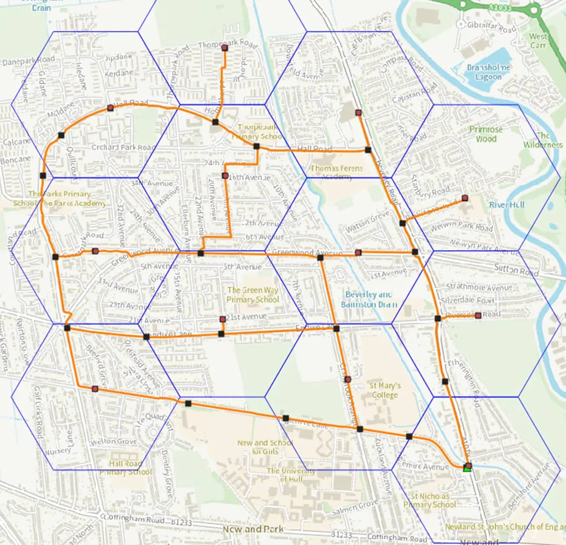
GIS SOLUTIONS
→Expert GIS and spatial analysis services for informed decision-making.
With a rich background in Geographic Information Systems, our team brings extensive expertise in both QGIS and ESRI platforms. Our deep understanding of GIS technologies and spatial analysis allows us to deliver sophisticated solutions for complex spatial challenges. As certified experts in leading GIS platforms, we provide not just technical solutions but strategic insights that drive informed decision-making.
- Spatial Data Analytics
- Infrastructure Management
- Environmental Analysis
- Smart City Development
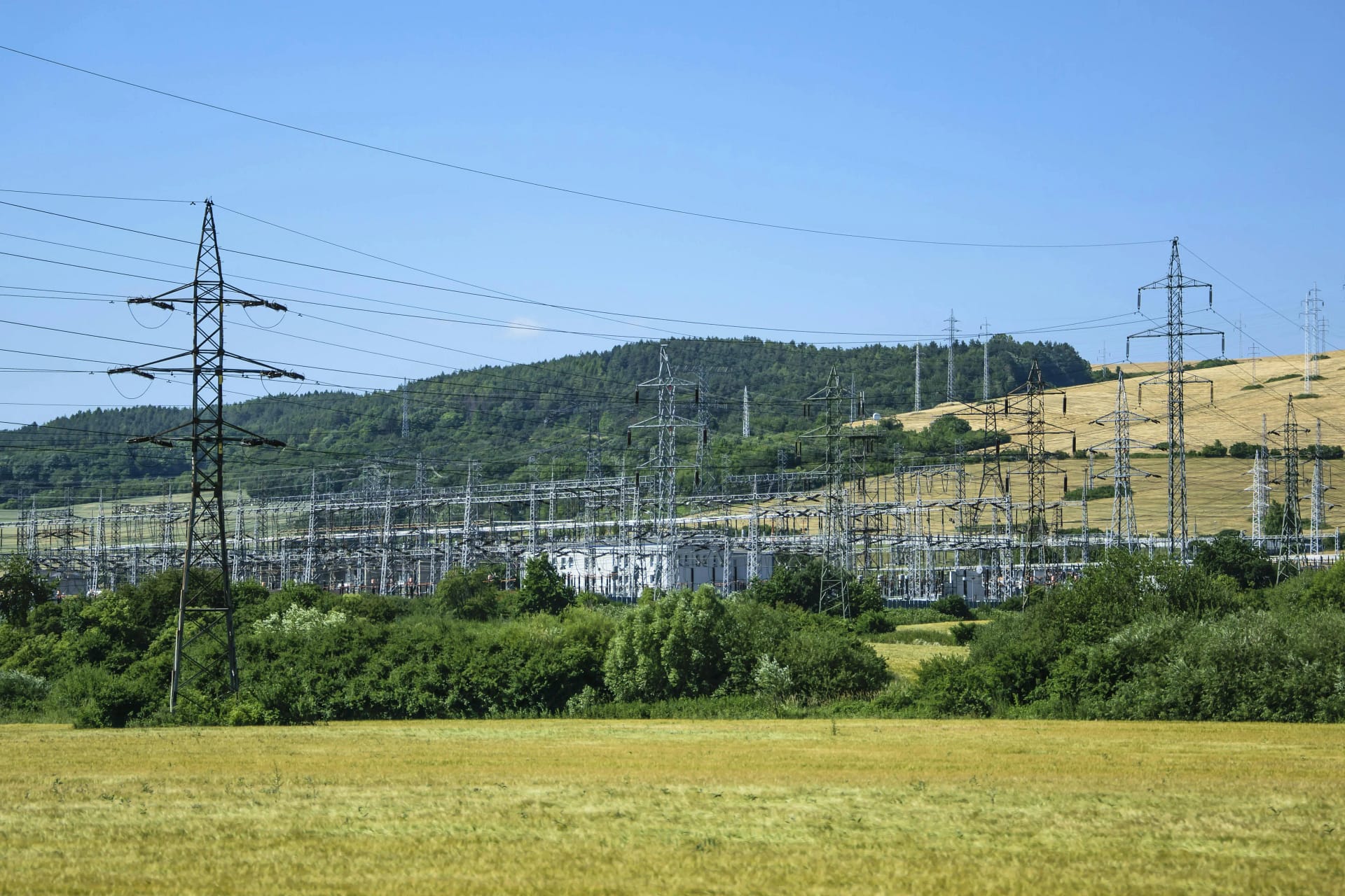
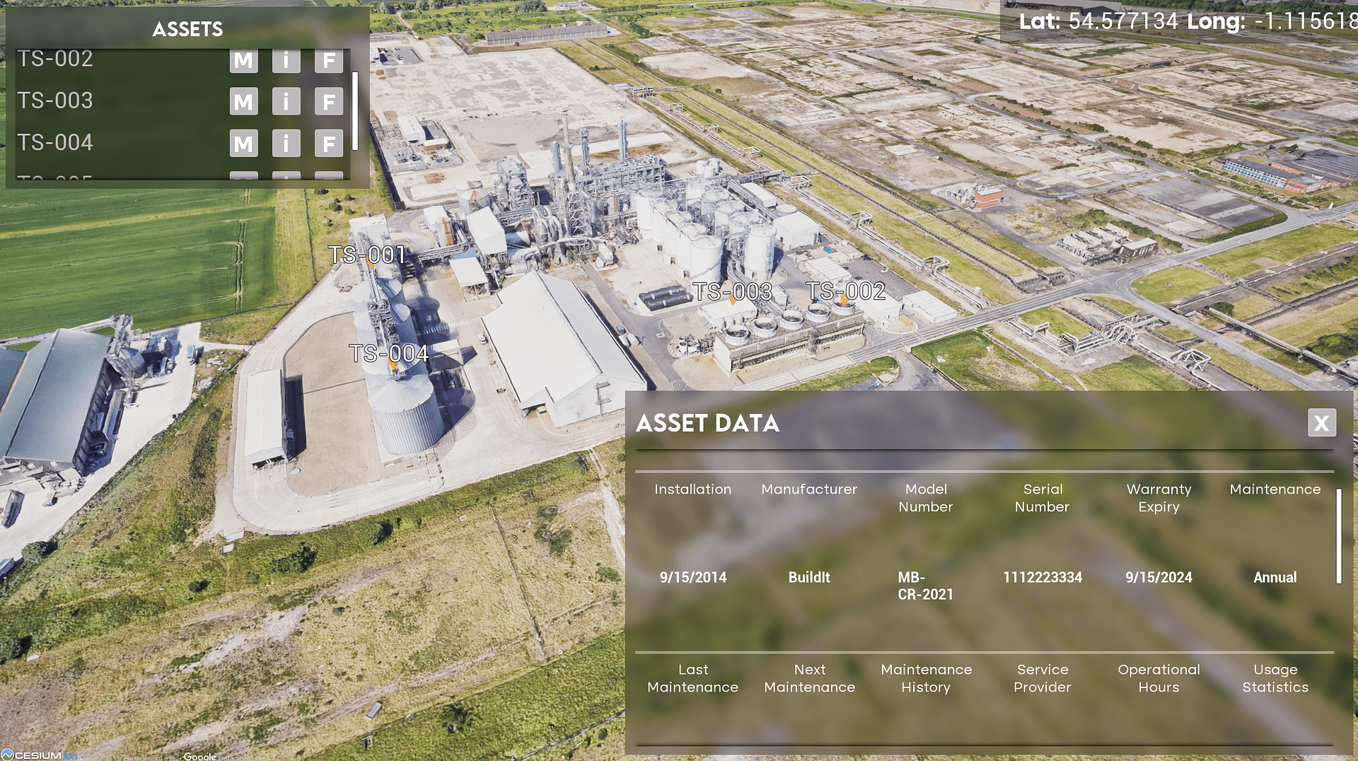
UTILITIES PLANNING
→Comprehensive planning and analysis for utility infrastructure.
Our utilities planning expertise is rooted in extensive experience with fiber network planning, particularly in complex German infrastructure projects. This foundation has evolved into comprehensive utilities planning capabilities, as the core principles of underground infrastructure planning - from trenching methodologies to network optimisation - are universal across utility types. Our proven track record in fiber planning translates seamlessly to water, gas, and other utility infrastructure projects.
- Network Planning
- Infrastructure Mapping
- Asset Management
- Capacity Analysis
SMART CITY
→Transforming urban environments through intelligent spatial solutions and connected infrastructure.
Our Smart City development services combine our expertise in GIS, spatial analysis, and digital infrastructure to create intelligent urban solutions. We leverage our experience in utilities planning and spatial data management to help cities become more efficient, sustainable, and livable through technology-driven solutions. Our approach integrates multiple urban systems into cohesive, data-driven platforms that enable better decision-making and resource management.
- Urban Infrastructure Digitisation
- IoT Integration & Sensor Networks
- Real-time Data Analytics
- Sustainable Urban Planning
- Connected Infrastructure Management
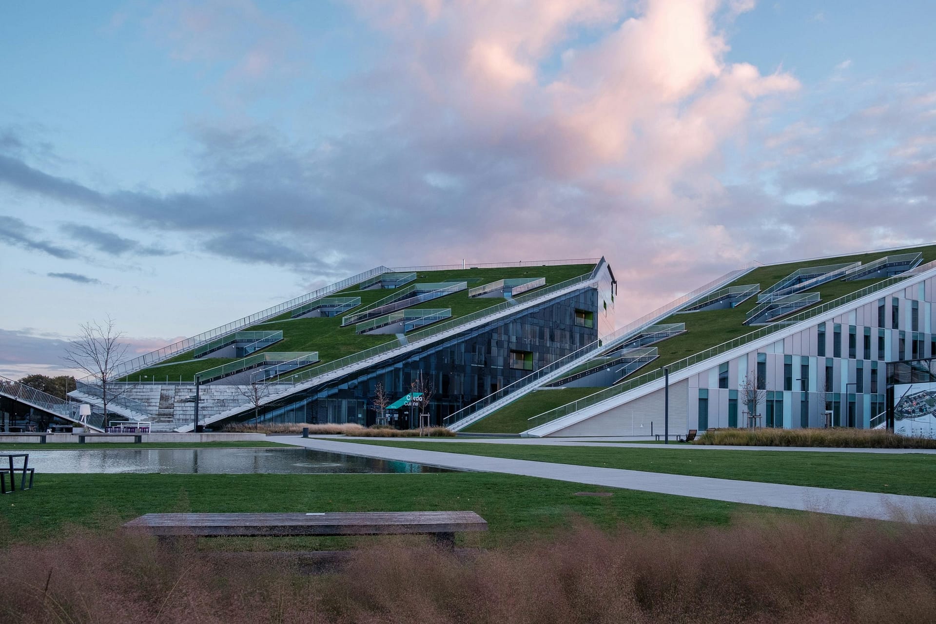
DIGITAL TWINS
→Creating precise digital replicas of physical assets and environments for enhanced visualization and analysis.
Our Digital Twin solutions represent the convergence of our surveying expertise, 3D modeling capabilities, and spatial analysis skills. Using advanced LiDAR technology and UAV imaging, we create highly accurate digital replicas of physical infrastructure and environments. These digital twins enable real-time monitoring, predictive maintenance, and sophisticated scenario planning, providing unprecedented insights for asset management and operational optimisation.
- High-Precision 3D Modeling
- Real-time Asset Monitoring
- Predictive Maintenance Solutions
- Virtual Site Inspections
- Interactive Visualisation Platforms
MARTYN'S LAW SERVICES
→Comprehensive security mapping and risk assessment solutions to meet Martyn's Law compliance requirements.
Our Martyn's Law services leverage our expertise in spatial analysis, 3D modeling, and digital infrastructure to help venues and organisations meet the requirements of the Terrorism (Protection of Premises) Act 2025. We combine UAV technology, thermal imaging, and advanced mapping capabilities to provide detailed security assessments, evacuation planning, and comprehensive documentation for public spaces and qualifying premises.
- Security Risk Assessments
- Venue Mapping & Documentation
- Evacuation Route Planning
- Capacity Analysis & Crowd Modeling
- 3D Security Visualization
- Compliance Documentation
REVOLUTIONISING INSURANCE
→Transforming how insurance claims are evidenced we can scan property & vehicle damage quickly creating accurate 3D Models.
Our insurance assessment services combine our expertise in 3D modelling, spatial analysis, and precision documentation to revolutionise claims processing. We leverage our experience in multi-platform data capture and georeferenced measurement to help insurance companies accelerate claim resolution, reduce disputes, and improve accuracy through technology-driven evidence collection. Our approach integrates UAV technology, handheld scanning, and thermal imaging into comprehensive assessment platforms that enable confident decision-making and precise damage quantification.
- Rapid Damage Assessment
- Precision Measurement & Quantification
- Real-time Data Analytics
- Remote Collaborative Assessment
- Comprehensive Evidence Collection
INNOVATIVE
SOLUTIONS FOR
COMPLEX CHALLENGES
SURVEYING
High-precision UAV surveys and LiDAR scanning for comprehensive spatial analysis.
Our surveying expertise combines cutting-edge UAV technology with advanced LiDAR systems to deliver unmatched precision in spatial data collection. With our fleet of specialised drones and experienced team, we provide detailed aerial surveys, accurate volumetric calculations, and comprehensive site documentation.
- Aerial Photography & Mapping
- Volumetric Analysis
- 3D Modeling & Digital Twins
- Site Documentation
WEB & SYSTEMS
Custom development solutions for enterprise-grade spatial applications.
Our web and systems development services emerged from our internal innovation journey. After developing sophisticated systems for our own workflows, we recognised our clients' need for more than just basic solutions. Our team's expertise in creating custom applications and integrated systems allows us to deliver comprehensive solutions that bridge the gap between spatial data and user-friendly interfaces.
- Custom Software Development
- Web Applications
- Database Management
- System Integration
GIS SOLUTIONS
Expert GIS and spatial analysis services for informed decision-making.
With a rich background in Geographic Information Systems, our team brings extensive expertise in both QGIS and ESRI platforms. Our deep understanding of GIS technologies and spatial analysis allows us to deliver sophisticated solutions for complex spatial challenges. As certified experts in leading GIS platforms, we provide not just technical solutions but strategic insights that drive informed decision-making.
- Spatial Data Analytics
- Infrastructure Management
- Environmental Analysis
- Smart City Development
UTILITIES PLANNING
Comprehensive planning and analysis for utility infrastructure.
Our utilities planning expertise is rooted in extensive experience with fiber network planning, particularly in complex German infrastructure projects. This foundation has evolved into comprehensive utilities planning capabilities, as the core principles of underground infrastructure planning - from trenching methodologies to network optimisation - are universal across utility types. Our proven track record in fiber planning translates seamlessly to water, gas, and other utility infrastructure projects.
- Network Planning
- Infrastructure Mapping
- Asset Management
- Capacity Analysis
SMART CITY
Transforming urban environments through intelligent spatial solutions and connected infrastructure.
Our Smart City development services combine our expertise in GIS, spatial analysis, and digital infrastructure to create intelligent urban solutions. We leverage our experience in utilities planning and spatial data management to help cities become more efficient, sustainable, and livable through technology-driven solutions. Our approach integrates multiple urban systems into cohesive, data-driven platforms that enable better decision-making and resource management.
- Urban Infrastructure Digitisation
- IoT Integration & Sensor Networks
- Real-time Data Analytics
- Sustainable Urban Planning
- Connected Infrastructure Management
DIGITAL TWINS
Creating precise digital replicas of physical assets and environments for enhanced visualization and analysis.
Our Digital Twin solutions represent the convergence of our surveying expertise, 3D modeling capabilities, and spatial analysis skills. Using advanced LiDAR technology and UAV imaging, we create highly accurate digital replicas of physical infrastructure and environments. These digital twins enable real-time monitoring, predictive maintenance, and sophisticated scenario planning, providing unprecedented insights for asset management and operational optimisation.
- High-Precision 3D Modeling
- Real-time Asset Monitoring
- Predictive Maintenance Solutions
- Virtual Site Inspections
- Interactive Visualisation Platforms
Revolutionising Insurance
Transforming how insurance claims are evidenced we can scan property & vehicle damage quickly creating accurate 3D Models.
Our insurance assessment services combine our expertise in 3D modelling, spatial analysis, and precision documentation to revolutionise claims processing. We leverage our experience in multi-platform data capture and georeferenced measurement to help insurance companies accelerate claim resolution, reduce disputes, and improve accuracy through technology-driven evidence collection. Our approach integrates UAV technology, handheld scanning, and thermal imaging into comprehensive assessment platforms that enable confident decision-making and precise damage quantification.
- Rapid Damage Assessment
- Precision Measurement & Quantification
- Real-time Data Analytics
- Remote Collaborative Assessment
- Comprehensive Evidence Collection