Mapping Entire Nations: The Technology Behind National-Scale Aerial Surveys

National Aerial Surveying: Fixed-Wing Technology for Territorial Mapping
National-scale aerial surveying operates at a scale that challenges conventional drone operations. Where a standard drone or UAV survey might cover a few square kilometres per deployment, fixed-wing aircraft can map thousands of square kilometres in a single flight, capturing territorial-scale data with survey-grade precision.
The technical demands are substantial. Achieving sub-100mm accuracy across entire regions requires coordination between multiple sensor systems, precise navigation, and processing infrastructure capable of handling terabytes of geospatial data. For governments, infrastructure operators, and defence organisations, this level of comprehensive territorial intelligence becomes essential for planning, security, and resource management. CreoPlan’s spatial intelligence solutions deliver this capability across infrastructure, defence, and government sectors.
National Aerial Surveying: Understanding Territorial-Scale Operations
A fixed-wing aerial survey covering 10,000 square kilometres generates approximately 15-20 terabytes of raw data. Processing this volume requires purpose-built workflows and validation protocols that extend far beyond standard photogrammetry projects.
Surveying Technology at National Scale: Aerial Mapping Entire Territories
These operations typically involve flight altitudes between 300 and 3,000 metres, depending on the required ground resolution and sensor specifications. At 500 metres altitude with a 50-megapixel sensor, achieving 5cm ground sample distance is technically feasible across extensive territories. The flight endurance of fixed-wing or small aircraft platforms enables efficient coverage that would require dozens of drone missions. The carrying capacity of the small aircraft is much less restricted than drones, this means that larger camera and LiDAR systems can be used to great effect.
The distinction between regional and national-scale operations isn’t merely about area. It’s about maintaining consistent accuracy standards across varied terrain, managing airspace permissions across multiple jurisdictions, and delivering integrated datasets that serve multiple stakeholders simultaneously.

Fixed-Wing Drones & Aerial Surveying: Technology for Territorial Mapping
Fixed-wing platforms offer distinct advantages for large-area coverage. Their aerodynamic efficiency translates to extended flight time and higher cruise speeds, whilst maintaining stable sensor platforms for consistent data capture. Where rotary-wing systems excel at detailed vertical inspections, fixed-wing aircraft are optimised for horizontal coverage at territorial scale.
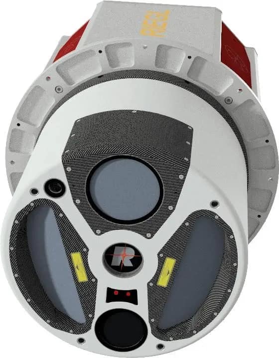
Modern survey-grade systems integrate multiple sensors simultaneously. LiDAR systems capture point cloud data with densities of 20-50 points per square metre, sufficient for detailed terrain modelling and infrastructure analysis. Photogrammetric cameras provide high-resolution orthomosaic imagery suitable for feature extraction and visual analysis. Multispectral sensors enable vegetation classification and agricultural monitoring. Thermal imaging identifies temperature differentials for infrastructure assessment and environmental monitoring.
Surveying Technology at National Scale: Aerial Mapping Entire Territories
Horizontal accuracy specifications of ±50mm are achievable through RTK/GNSS integration with ground control points strategically positioned across the survey area. Vertical accuracy typically reaches ±75mm, meeting requirements for court-admissible documentation under UK Civil Evidence Act 1995 and equivalent international standards.
Data capture rates depend on sensor configuration and flight parameters, but a well-planned mission can acquire 500-1,000 square kilometres per day under optimal conditions. Ground control point integration follows RICS standards, with monumented positions verified through differential GNSS methods achieving centimetre-level precision. The coordination between airborne sensors and ground-based verification creates datasets that satisfy quality standards. Processing workflows handle geometric correction, radiometric calibration, and point cloud classification through automated and semi-automated methods, with final validation conducted by qualified surveyors.

Territorial Mapping Services for Infrastructure and Defence
Infrastructure and utilities mapping at national scale reveals patterns invisible in localised surveys. Transport network analysis identifies maintenance priorities across thousands of kilometres of highways and rail. Power grid monitoring detects vegetation encroachment and structural issues before they impact service delivery. Water system mapping traces pipeline networks and identifies potential contamination pathways across catchment areas.
Defence and security applications require different specifications entirely. Tactical intelligence gathering benefits from rapid deployment capabilities and multi-sensor integration. Border monitoring operations demand consistent coverage over extended linear features, often in challenging terrain. Threat assessment relies on change detection between successive survey epochs, identifying modifications to infrastructure or terrain that warrant further investigation.
Mining and energy sector applications include volumetric analysis of stockpiles and excavations, environmental impact assessment for extraction operations, and site rehabilitation monitoring. The survey-grade accuracy enables contractual verification and regulatory compliance reporting.
Surveying Technology at National Scale: Aerial Mapping Entire Territories
Environmental monitoring at territorial scale provides baseline data for resource management decisions. Forestry operations use multispectral data to classify species and assess biomass. Agricultural monitoring tracks crop health across entire regions, informing policy decisions about irrigation and land use. Coastal erosion analysis compares LiDAR surveys from different time periods, quantifying sediment transport and informing coastal defence strategies.
Emergency services deploy national-scale data during disaster response. Flood mapping combines historical terrain data with current conditions to predict inundation patterns. Earthquake assessment compares pre-event and post-event surveys to identify structural damage and plan recovery operations. The speed of data acquisition becomes critical when decisions affect public safety.
Urban planning authorities use territorial surveys for growth analysis and development compliance. Comparing surveys from different years quantifies urban expansion and informal settlement growth. Planning compliance verification identifies unauthorised construction and encroachment on protected land. The comprehensive coverage removes sampling bias inherent in ground-based inspections. Smart City planning can be made much easier and effective utilising GIS tools.

International Surveying Projects: Deployment and Compliance
Regulatory compliance varies significantly across jurisdictions. UK operations follow CAA regulations and CAP 722 guidance. European deployments require EASA authorisation. Projects in North America navigate FAA Part 107 requirements or equivalent Canadian regulations. Each jurisdiction imposes distinct requirements for pilot certification, airspace permissions, and operational procedures.
Airspace coordination for national-scale operations involves multiple aviation authorities, military installations, and commercial flight paths. Obtaining permissions requires detailed flight planning documentation, proof of insurance, and often diplomatic coordination for cross-border operations. The process typically requires 4-8 weeks lead time, extending to several months for defence-related deployments.
Surveying Technology at National Scale: Aerial Mapping Entire Territories
Logistics planning addresses mobilisation timelines, local partnerships for ground support, and equipment transport across international borders. Multi-crew operations become necessary for projects exceeding several weeks duration, requiring accommodation, vehicle hire, and secure data storage facilities. Project management at this scale demands experience with international customs procedures, temporary import permits, and export control regulations for sensitive surveying equipment.
Data processing infrastructure must handle the scale of information generated. A national survey produces datasets too large for standard workstation processing. Cloud-based processing clusters or high-performance computing facilities become essential. The processing timeline for a 10,000 square kilometre survey typically ranges from 2-4 weeks, depending on deliverable specifications and quality assurance requirements.
Integration with client GIS platforms requires compatibility with ESRI ArcGIS, QGIS, Bentley MicroStation, and AutoCAD Civil 3D. Data delivery follows standardised formats: LAZ for point clouds, GeoTIFF for orthomosaics, and DXF for vector features. Metadata complies with high standards, documenting accuracy specifications, coordinate reference systems, and processing methods.
Quality assurance processes include independent check surveys covering 5-10% of the project area, comparison against existing control networks, and statistical analysis of accuracy metrics. Verification reports document compliance with specified tolerances and identify any areas requiring reacquisition. The deliverable includes full accuracy statements and uncertainty quantification.

Managing Terabyte-Scale Geospatial Data from National Surveys
A national-scale survey generates 10-25 terabytes of processed deliverables. Point cloud & LiDAR data comprises the largest volume, often several terabytes for comprehensive coverage. Orthomosaic imagery adds additional data especially when processed at the 5cm resolution CreoPlan uses as a standard. Vector layers, digital terrain models, are all part of comprehensive geospatial data.
Processing infrastructure requires substantial computational resources. Point cloud classification through automated algorithms handles initial processing, with manual refinement for critical features. Orthomosaic generation involves thousands of individual images aligned through photogrammetric bundle adjustment. The computational demand necessitates parallel processing across multiple servers or cloud computing instances.
Cloud-based delivery platforms enable client access without physical media transfer. CreoPlan has created its own secure portals provide streaming access to point cloud data through platforms like CreoViewer, eliminating the need to download entire datasets. ViewMore360 integration creates navigable panoramic views derived from aerial imagery, useful for public engagement and stakeholder visualisation. For large national-scale surveying projects, government and defence organisations often require data to remain within their own secure infrastructure. In these cases, deliverables are provided on encrypted physical media or transferred directly to client-controlled servers.
Standardised formats ensure long-term accessibility. LAS/LAZ files store point cloud data with standardised classification codes. GeoTIFF provides georeferenced raster imagery compatible with all major GIS platforms. Shapefiles and GeoPackage formats deliver vector data. DEM and DSM products use industry-standard grid formats. All deliverables include comprehensive metadata documenting coordinate reference systems, accuracy specifications, and processing methods.
Surveying Technology at National Scale: Aerial Mapping Entire Territories
Long-term data management considerations include format migration strategies, backup protocols, and version control for updated surveys. Clients conducting repeat surveys require datasets structured for efficient change detection and temporal analysis. Archive formats must remain accessible as software evolves, necessitating open standards rather than proprietary formats.
Integration with existing client systems varies by organisation. Government agencies often maintain enterprise GIS platforms requiring specific schema compliance. Utilities operate asset management systems with defined data models. Defence organisations impose security classifications and access restrictions. The delivery specification accommodates these diverse requirements through flexible format options and customised metadata.
Validation and accuracy reporting provides statistical evidence of survey quality. Reports include root mean square error calculations comparing survey points to independent check measurements. Accuracy statements specify horizontal and vertical tolerance compliance across different terrain types and land cover categories. The documentation supports regulatory submissions and provides audit trails for contractual compliance.

Territorial Intelligence at Scale
National-scale aerial surveying represents a distinct capability beyond conventional project work. The technical requirements, regulatory complexity, and logistical coordination demand experience with international deployments and multi-sector operations.
CreoPlan’s work in territorial intelligence extends across infrastructure, defence, and government sectors, with fixed-wing platforms complemented by drone integration where enhanced detail or ground-truthing supplements airborne coverage. The combination of survey-grade accuracy, rapid processing capabilities, and international deployment experience positions the company for complex cross-border projects requiring both technical sophistication and operational reliability.
Discuss large-scale international surveying requirements with our team.
www.creoplan.co.uk
info@creoplan.co.uk