we create maritime digital twins
increase the efficiency of
infrastructure monitoring for your business
01
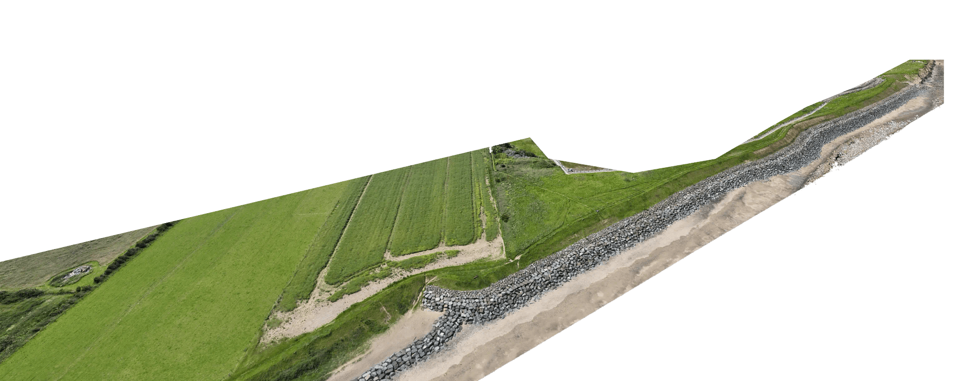
Coastal Erosion
High-precision monitoring of coastline changes using advanced drone technology and LiDAR scanning. Track erosion rates with millimeter accuracy.
- Bi-monthly surveys with temporal analysis
- Accurate erosion rate calculations
- Risk assessment and prediction modeling
- Detailed reporting and visualisation

1.5m
Average Annual Erosion Rate
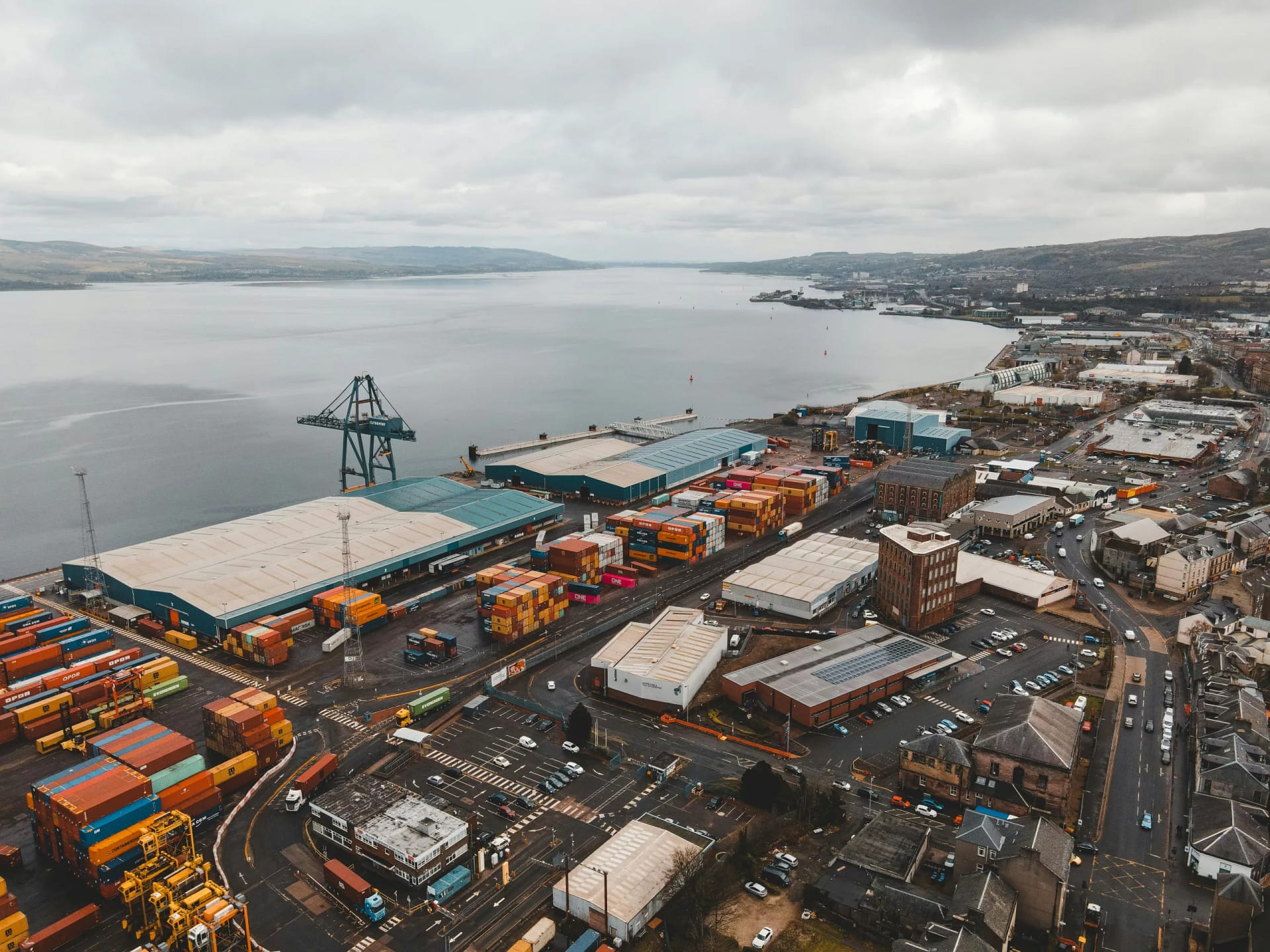
02
Port Facilities
Comprehensive digital twin solutions for port infrastructure management and maintenance planning.
- 3D modeling of port infrastructure
- Asset condition monitoring
- Maintenance scheduling optimisation
- Safety and compliance assessment
0.5mm
Measurement Accuracy
03
Harbour Monitoring
Real-time monitoring and analysis of harbour infrastructure using advanced sensor networks and digital twin technology.
- Structural health monitoring
- Environmental impact assessment
- Traffic flow optimisation
- Safety system integration
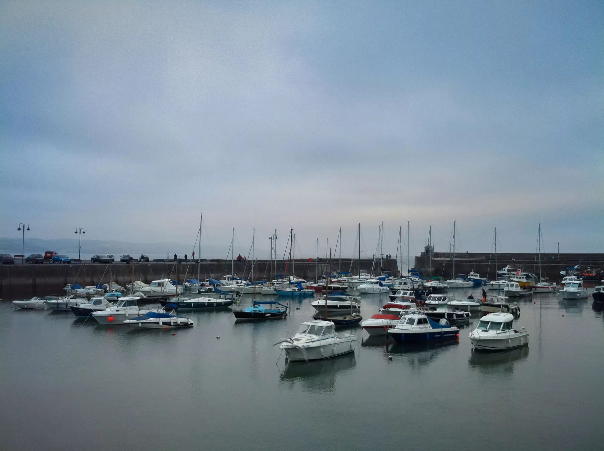
24/7
Real-time Monitoring
04
Waterway Management
Comprehensive waterway monitoring and management solutions using advanced scanning and modeling technologies.
- Depth monitoring and mapping
- Sediment transport analysis
- Navigation channel maintenance
- Environmental compliance monitoring

many miles
Waterway Coverage
05
Maritime Structures
Advanced structural monitoring and assessment of maritime infrastructure using precision scanning and modelling.
- Structural integrity assessment
- Wear and damage detection
- Maintenance planning
- Risk assessment and mitigation
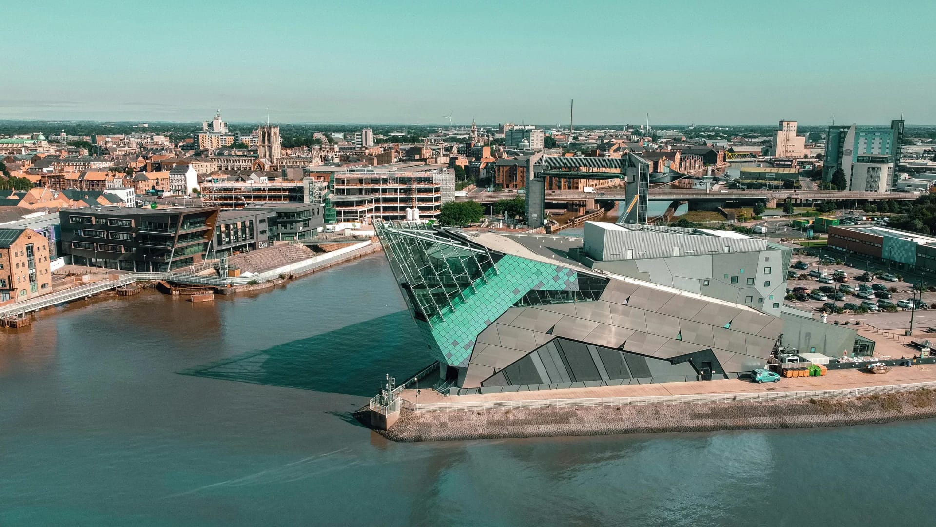
3D
Digital Twin Modelling
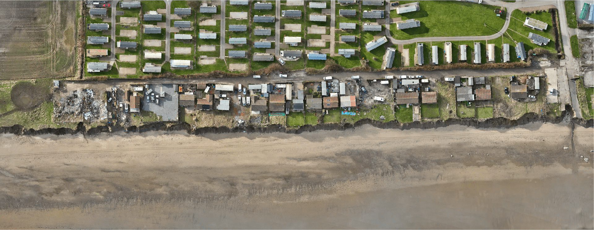

Before - February 2024
After - February 2025
our solutions
01
CreoViewer
Web-Based Point Cloud Visualisation
Accuracy
Sub-millimeter precision
Access
Browser-based platform
Integration
Real-world georeferencing
02
ViewMore360
Interactive Virtual Site Tours
Coverage
Complete site documentation
Quality
4K HDR imagery
Integration
Asset management ready
03
UAV Surveys
Advanced Aerial Data Capture

Equipment
Enterprise-grade drones
Capabilities
LiDAR, thermal, RGB
Analysis
Advanced data processing