Rapid 3d Modelling
Model Faster, Plan Smarter – Rapid 3D Modelling for Accurate Digital Twins
Rapid Modelling Workflow
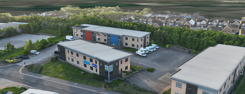
UAV Survey
UAV Survey is the first step in the process this provides the bases of the model, quickly & accurately, all the UAVs are GeoRectified.
Point Cloud Model
The Data is processed in house creating a point cloud model with the textures are added from the drone photography & GeoRectified photogrammetry Data is already applied providing up to 0.8mm accuracy.
3D Model Solidification
CreoPlan can provide a true 3D model with up to a LOD500 amount of detail. Utilising the high quality images from the UAV the model is made photo-real.
Digital Twin AR and VR Capabilities
With CreoPlan the Digital Twin can be explore digitally within a virtual environment. Accessed anywhere on any device & can act as AR. Information can be applied to the model as its built, and can be use in the virtual environment providing an XR experience.
Applications
How can a CreoPlan Model Help you?
Marketing
- 3D Virtual Tours: Real estate agents can use rapid 3D modelling to create immersive virtual tours of properties, allowing potential buyers to explore home externals or whole neighbourhoods commercial spaces from anywhere in the world.
- Property Visualisation: Before construction, developers can use 3D models to showcase upcoming properties, helping to attract investors and buyers by providing a realistic preview of the finished project.
- Customizable Interiors: Clients can use interactive 3D models to experiment with different interior design options, from furniture layouts to colour schemes, helping them make decisions that match their personal preferences.
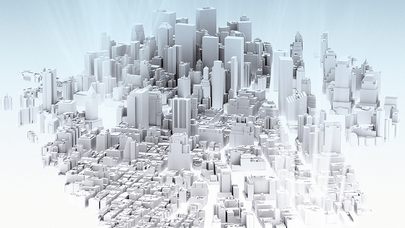
Planning & Infrastucture
- City Infrastructure Visualisation: Rapid 3D modelling allows urban planners to create detailed 3D representations of cities. These models can be used to visualise current infrastructure, simulate future developments, and plan for sustainable growth.
- Smart City Simulations: 3D models can simulate traffic flow, pedestrian movement, and other urban dynamics, helping planners make informed decisions about public transport, road networks, and public spaces.
- Public Engagement: Interactive 3D models of proposed developments can be shared with the public, allowing for better communication and engagement with community stakeholders.
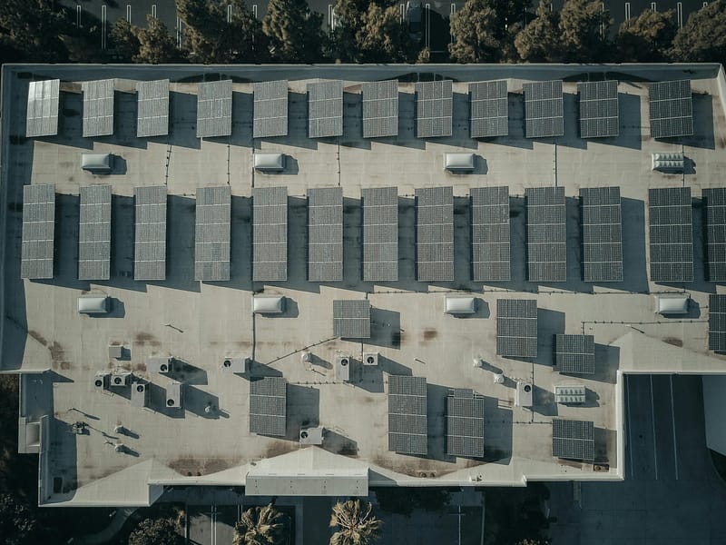
Roof Surveys & Solar Panel Planning
- Detailed Roof Geometry: Rapid 3D modelling allows for the precise mapping of roof structures, capturing the exact dimensions, angles, and features of any rooftop. This includes identifying chimneys, skylights, and other obstructions that could impact the placement of solar panels.
- Condition Assessment: High-resolution 3D models can be used to assess the condition of the roof, identifying areas that may require repair or reinforcement before solar panel installation.
- Pre-Installation Planning: Detailed 3D models streamline the installation process by providing installers with exact measurements and a clear plan of action. This reduces the likelihood of errors and delays during installation.
- Safety and Compliance: The models can be used to ensure that the installation meets all safety regulations and building codes, reducing the risk of compliance issues.
Ready to Solve your Spatial Problems?
Get in touch here and we can start you on the journey to a satisfying and successful solution.