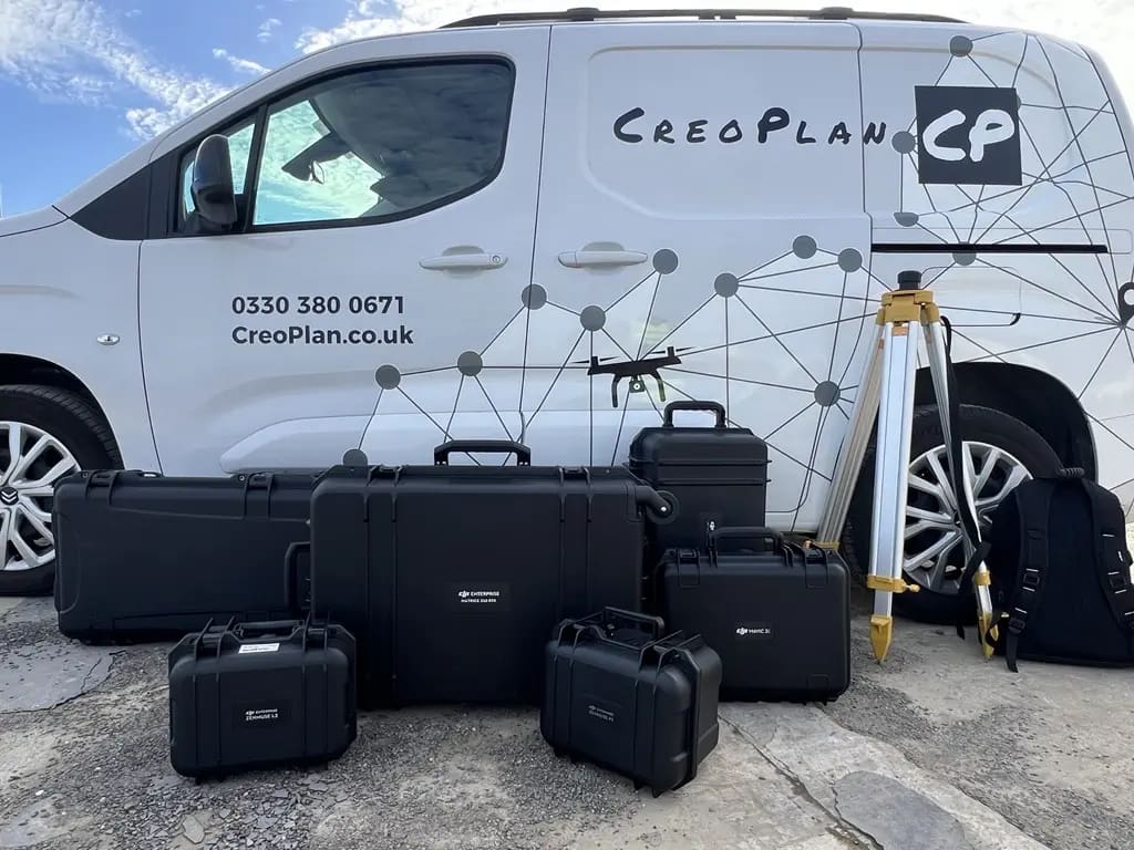
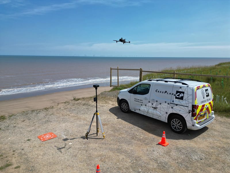
Precision Spatial Intelligence for
Large Projects
Enterprise-grade surveying solutions combining UAV and manned aircraft capabilities. When scale, speed, and accuracy aren't negotiable.
How it Works
CreoPlan delivers spatial intelligence for projects that demand absolute precision at scale. We combine drone surveying for detailed site work with aerial survey capabilities for regional coverage, providing seamless data across projects of any size.
Surveying Capabilities
01
Multi-Platform Surveying Operations
Our integrated approach deploys the right technology for your project scale. UAV systems deliver sub-2cm accuracy for detailed site work, whilst our aerial survey operations efficiently capture hundreds of square miles for regional planning and large-scale infrastructure projects.
Site-level detail
RTK drone surveys for construction and development sites
Regional Mapping
Manned aerial surveys for multi-site programmes and infrastructure corridors
Flexible Deployment
Single vendor solution from property to portfolio scale
Sector Expertise
02
Construction & Infrastructure
From single-site monitoring to multi-state construction programmes, we deliver the spatial data that keeps projects on schedule and on budget.
Drone Surveying
- Progress monitoring & volumetric analysis
- As-built verification against design models
- Thermal surveys for envelope integrity
- Safety compliance documentation
Aerial Surveying:
- Corridor mapping for highways, rail, and utilities
- Multi-site programme coordination
- Regional development planning
- Pre-construction baseline establishment
Oil, Gas & Mineral Operations
03
Topographic & Aerial Surveys
Supporting exploration, extraction, and infrastructure development across resource operations.
Exploration
Site characterisation and route planning & pipeline and transmission corridor surveying
Compliance
Lease boundary and access road mapping & environmental documentation
Government GIS Infrastructure
04
Our surveys integrate with GIS platforms
We deliver survey-grade data at the scale government planning requires – multi-county or country wide regional studies.
Infrastructure Management:
- Regional & county-wide baseline mapping
- Infrastructure asset inventories
- Transportation network documentation
Environmental Safety:
- Flood risk and watershed analysis
- Environmental monitoring and compliance
- Emergency response planning datasets
Our Technology
We invest in the right equipment and processing capabilities for survey-grade precision
Rapid Deployment
Mobilise nationally within 48 hours for urgent projects
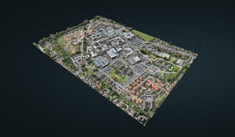
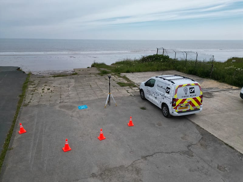
Survey-Grade Accuracy
RTK/GNSS positioning delivering ±2cm horizontal, ±3cm vertical precision
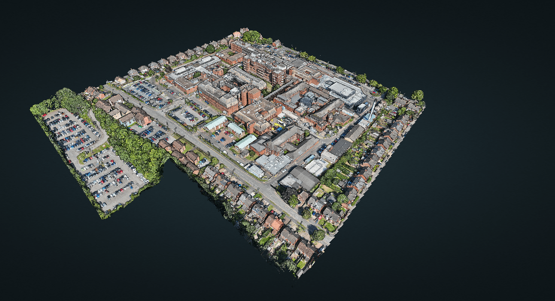
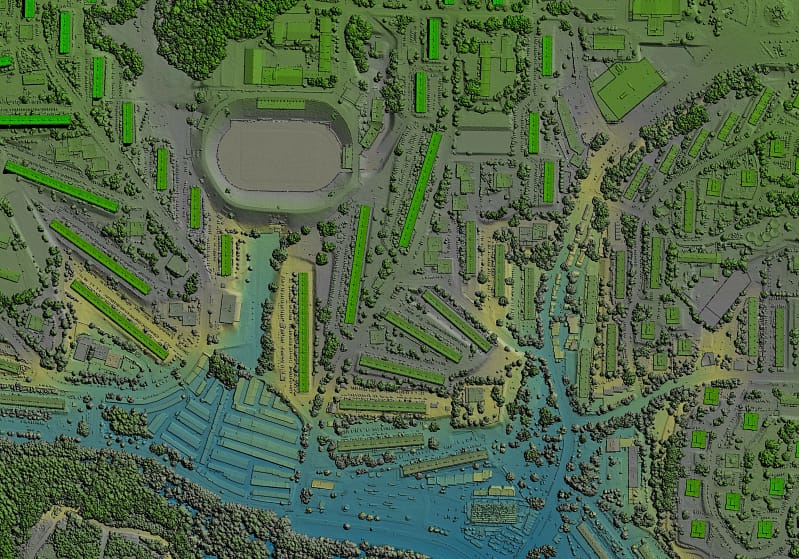
Interactive Visualisation
CreoViewer platform provides browser-based access to 3D models and point clouds
Seamless Integration
Deliverables compatible with AutoCAD, ArcGIS, and other standard formats
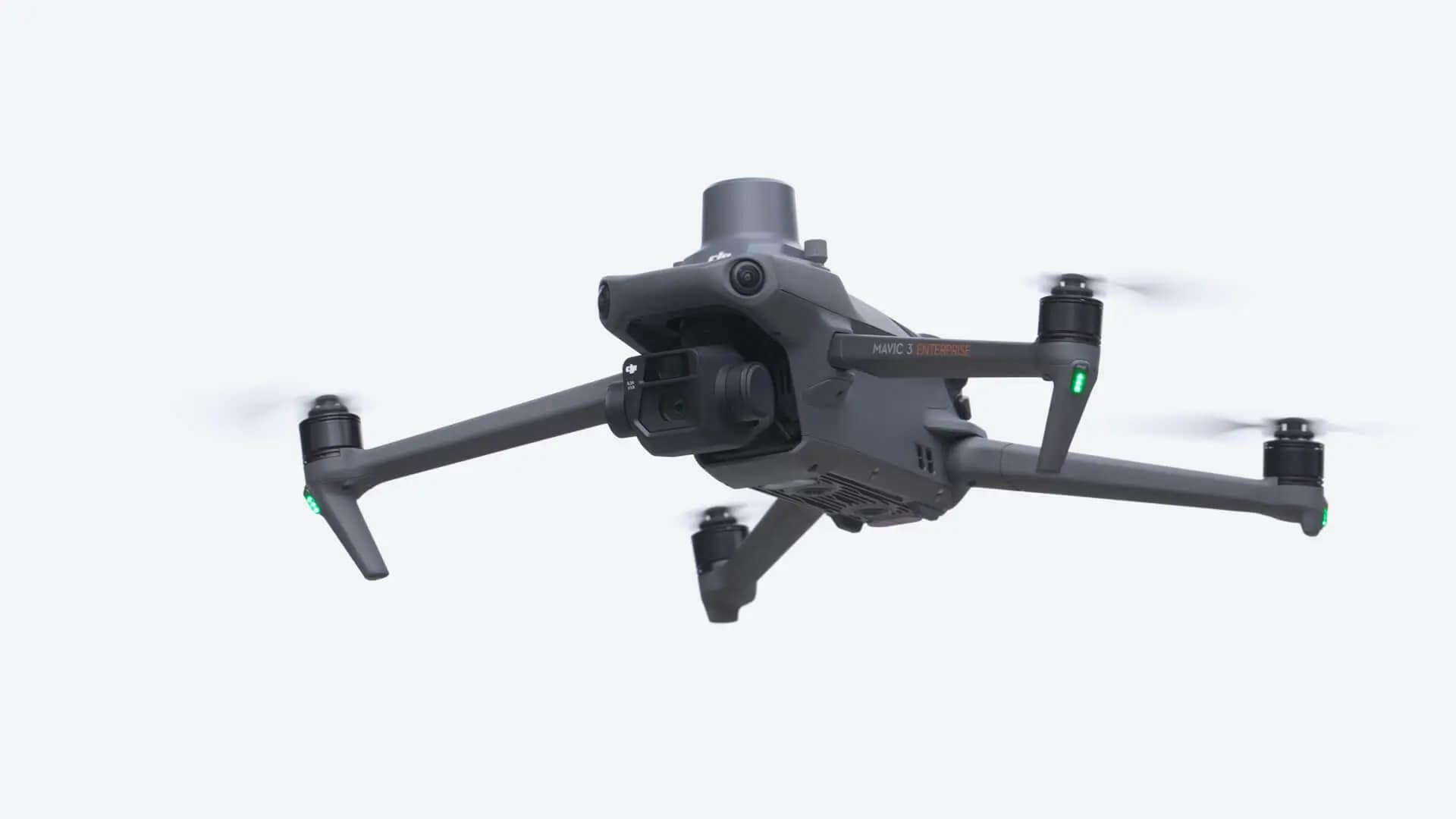
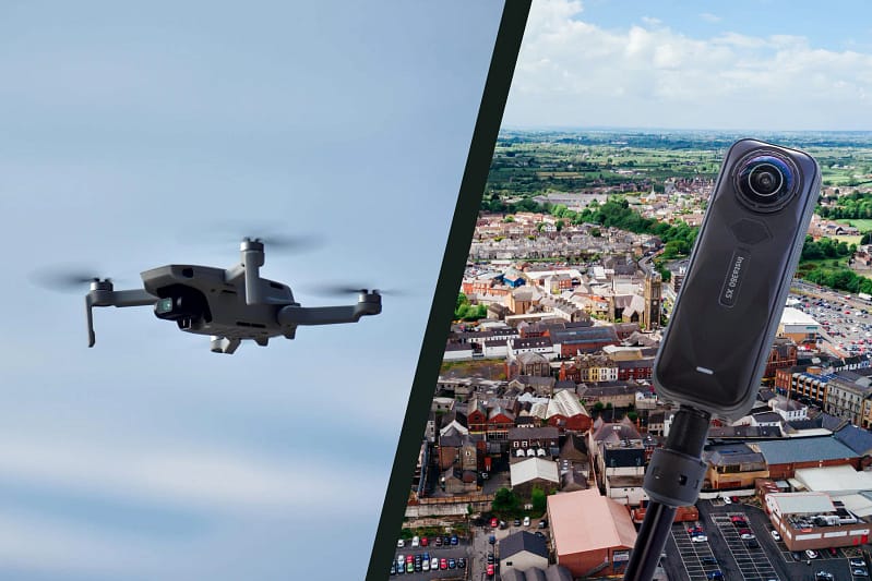
Drone Fleet
Professional UAV platforms equipped with LiDAR and thermal imaging capabilities for detailed site surveys.
Handheld Camera & Equipment
Professional-grade 360° camera systems and LiDAR for interior documentation.
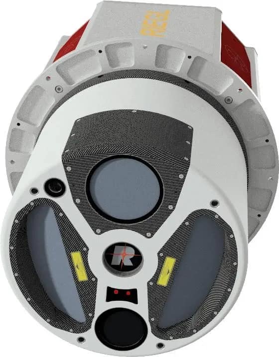
Aerial Survey Aircraft & Photography Equipment
Manned aircraft equipped with precision mapping cameras and LiDAR systems for large-scale mapping & surveying
Specialist Processing Software
Proprietary and industry-leading photogrammetry platforms processing raw survey data into many deliverables.
Our Clients
Our clients operate where mistakes are costly and accuracy is non-negotiable. Small projects up to regional government planning, these projects demand the best spatial intelligence.
Ready to Start a Project with us?
Project Approach
Requirements Analysis
We assess project scope, coverage area, accuracy requirements, and delivery timeline to recommend the optimal survey approach.
Deployment Planning
Coordinating UAV operations, aerial survey flights, and ground control to maximise efficiency and data quality.
Data Collection
Executing surveys with appropriate platforms whilst maintaining consistent positioning accuracy across all collection methods.
Processing & QA
Survey-grade processing with comprehensive quality control and accuracy verification.
Delivery & Support
Formatted deliverables with ongoing access to interactive 3D models and technical support.
The implementation at Diana, Princess of Wales Hospital in Grimsby and Scunthorpe General Hospital has shown the immense value of real-time, interactive 3D models that are easily accessible from any NHS workstation.
Alex Best - Group Director Capital Development - NHS
About Us
CreoPlan delivers spatial intelligence for projects that demand precision at scale.
We combine drone surveying, handheld scanning, aerial mapping, and advanced processing to serve construction, infrastructure, resource extraction, and government clients across the United States.
When Scale Demands Sophistication
CreoPlan serves clients where technical precision isn’t optional:
✓ Multi-state infrastructure programmes requiring consistent data standards
✓ Resource operations spanning thousands of acres
✓ Government planning projects requiring survey-grade regional datasets
✓ Construction programmes with aggressive timelines and zero tolerance for rework
✓ Projects where court-admissible documentation is essential